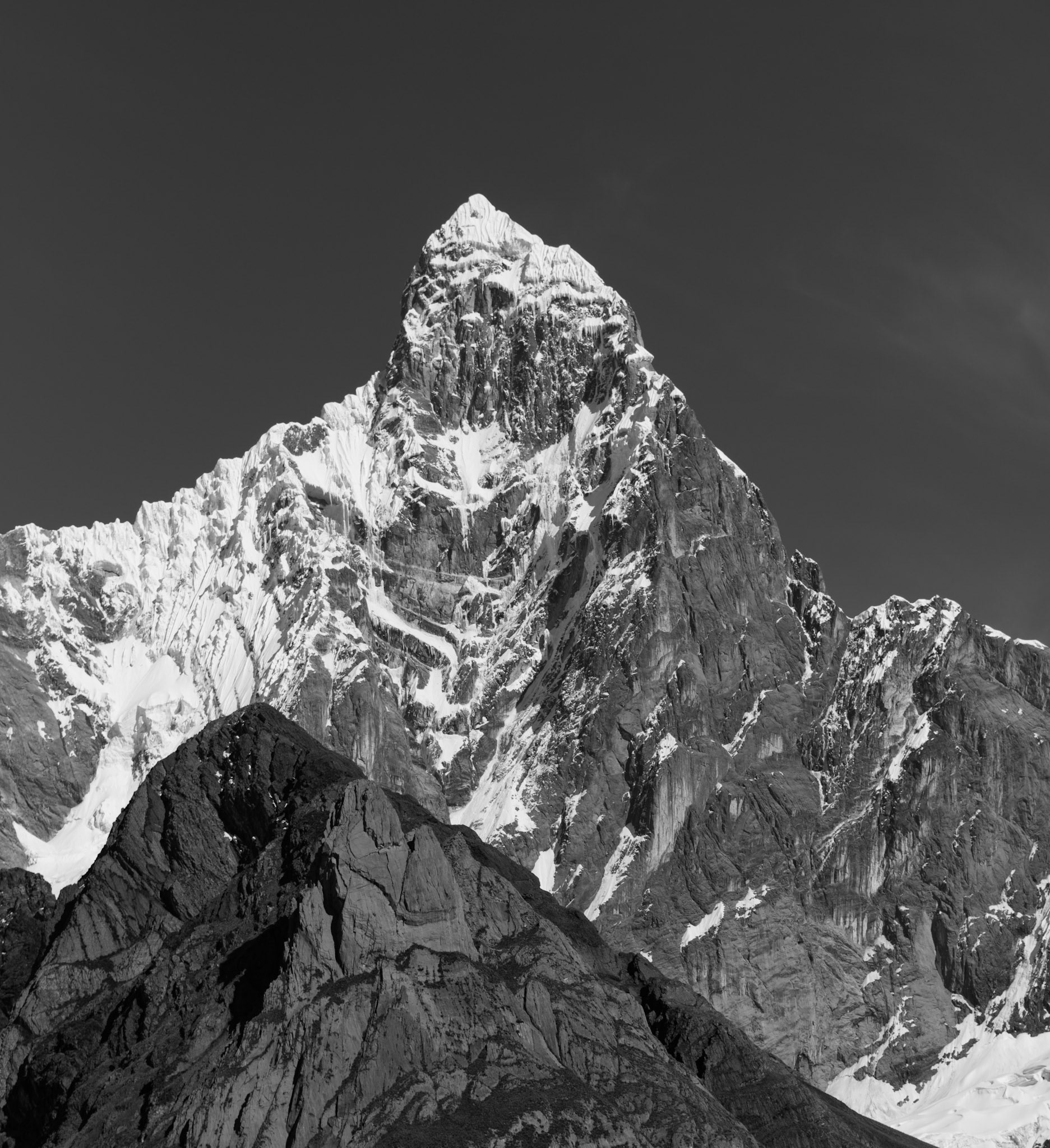
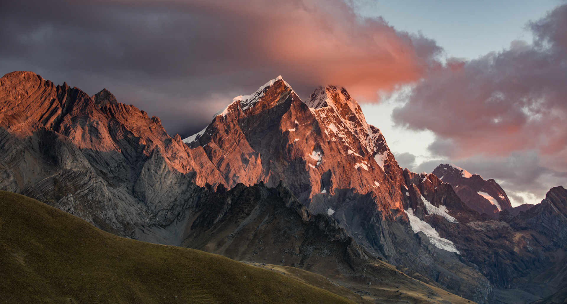
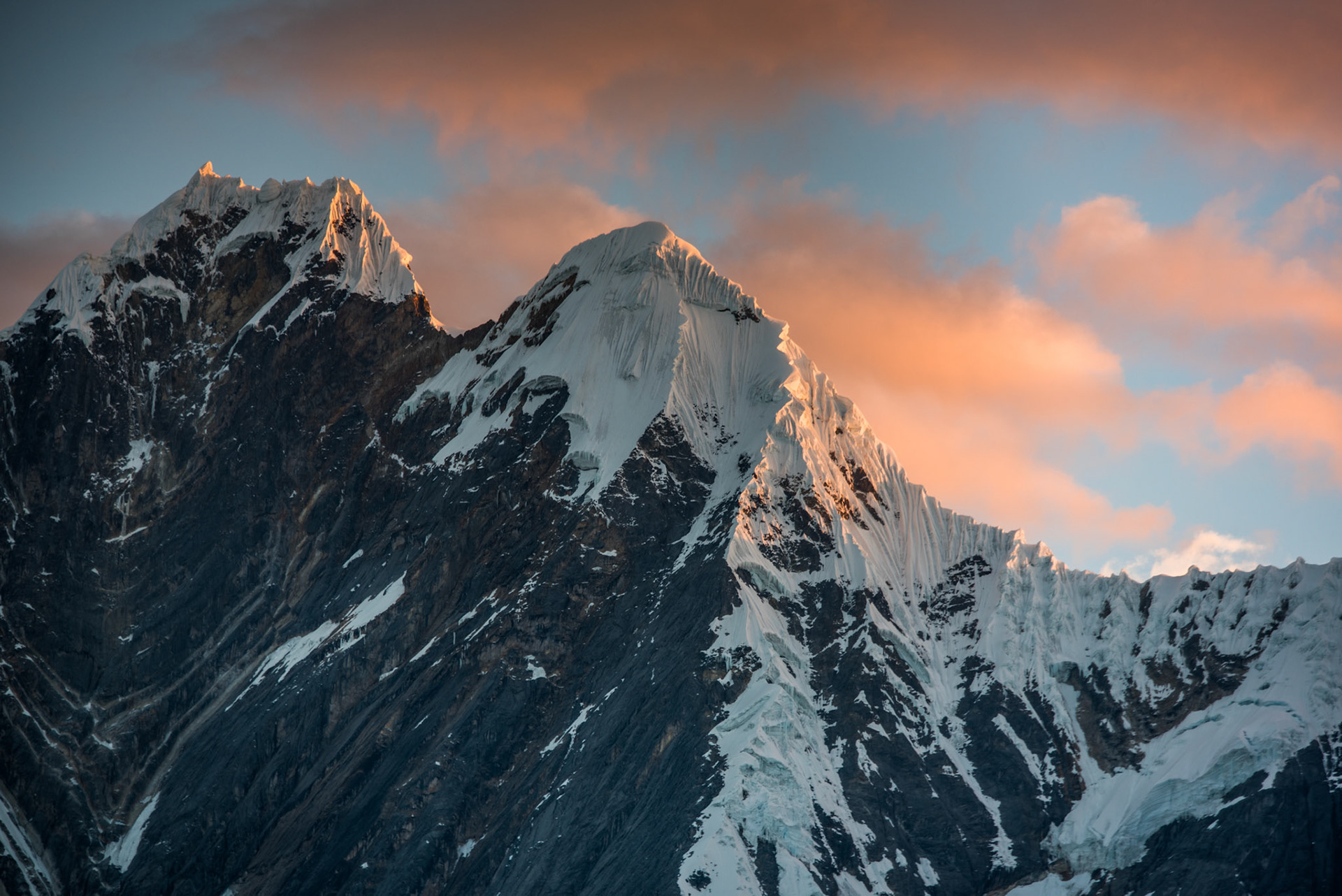
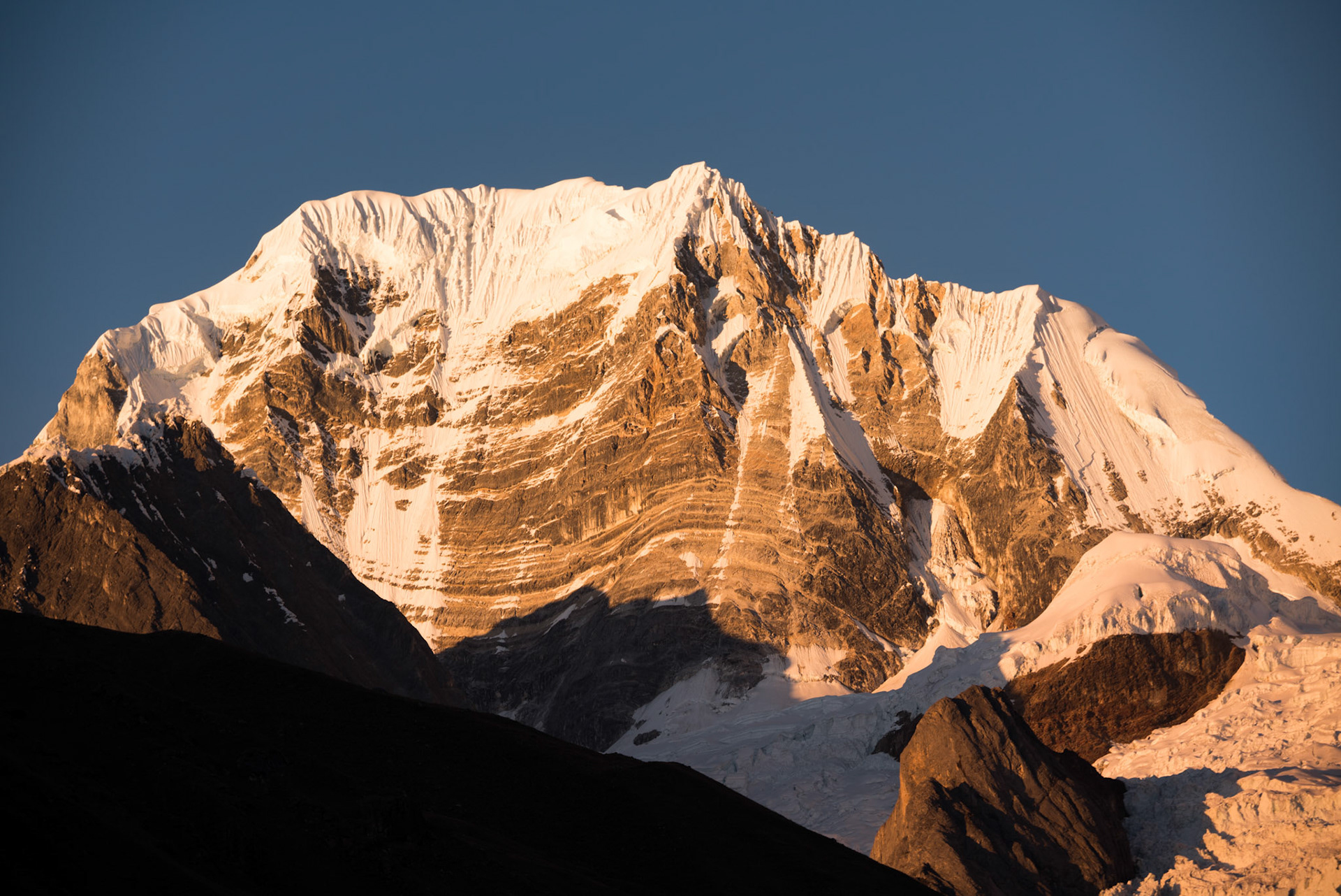
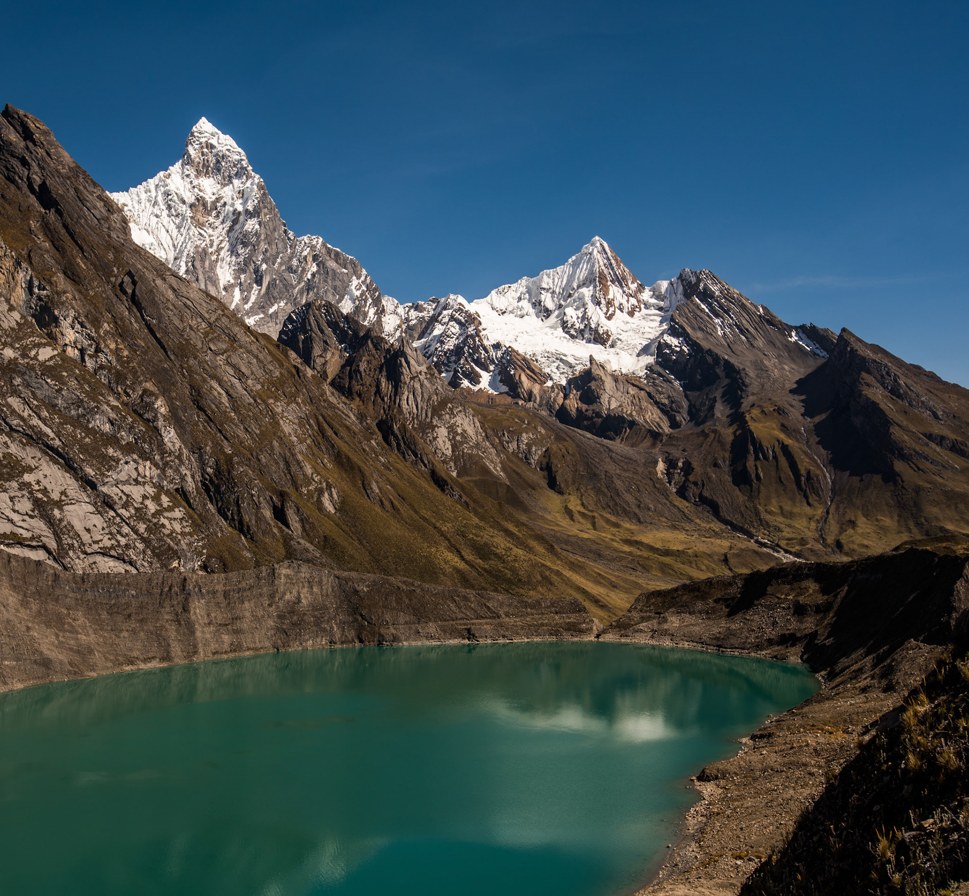
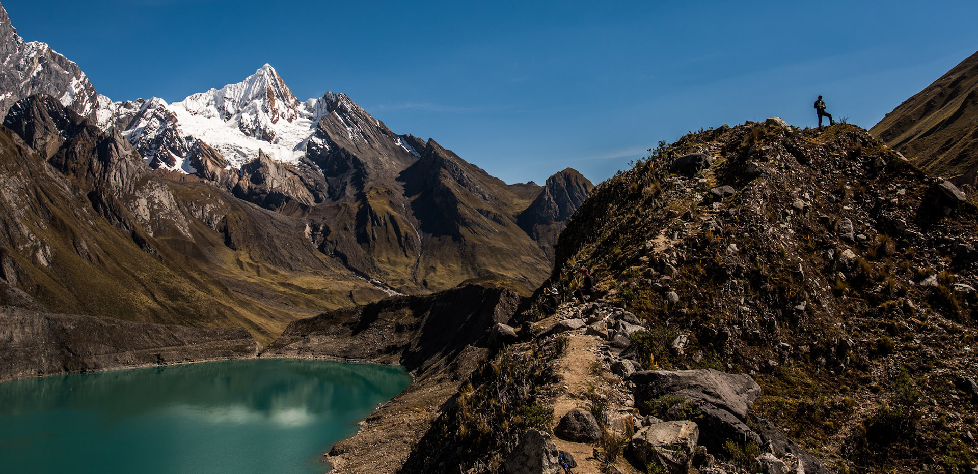
Mount Jirishanca, 6094 m above sea level

Three years after my travels to Peru, I have finally decided to piece together and connect my memories with the photographs that I took along the way. Here are my recollections to the best of my knowledge.
My first memory of this trip is when I realised 24 hours before my departure that I needed an electronic visa to pass through the first leg of the flight into the US. The visa could have taken anything up to 72 hours to arrive, but luckily, I got it through just in the nick of time to pass through their checks. I was glad to be on the flight heading to Lima, Peru.​​​​​​​
Home to nearly 11 million Peruvians, Lima is very much a megacity. I spent the first day exploring the city and enjoying the views across the Pacific Ocean. The next day, I was set to meet the group of people that I would be trekking with around the Andes. After meeting our guides and eating out for dinner, we departed for the alpine city of Huaraz. On our 7-hour coach journey, we passed out of Lima city centre and headed past great swathes of slum housing set on dry and dusty hills. The number of stray dogs traipsing around the streets was astonishing. It seemed like a very good precaution that I had my rabies jab for the trip. After a series of incredible mountain views, we arrived in Huaraz for the night. Sitting more than 3000 metres above sea level, this town was the base point for our ascent into the hills.
​​​​​​​

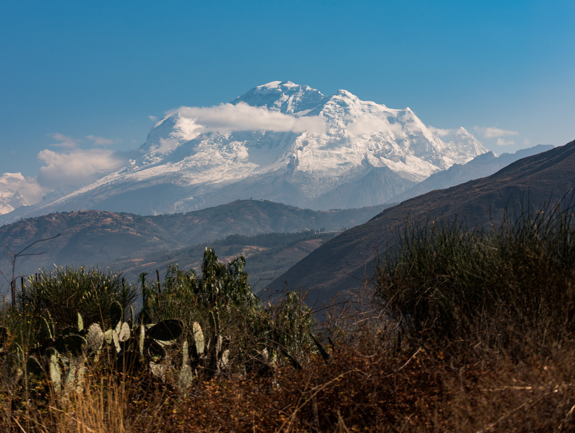
Mount Huascarán, 6768 m

We spent a day acclimatising to the altitude, heading on a minibus up to the Cordillera Blanca mountain range, passing into Huascarán National Park. We stopped at a viewpoint to see Mount Huascaran as seen above, towering at 6768m above sea level. One of our guides Ronal said he had climbed to its peak earlier in the year. As a man coming from the familiar sights of the English Lake District, this was just on another level to me.  The roads were treacherous and windy, with steep drops on either side. It was hair raising when we had to pass a truck coming down the track. I call it a road, but it was more an incredibly bumpy assortment of stones. After an arduous descent, we made it to the stunning Llanganuco Lakes, sitting 3850m above sea level. We then travelled even higher to just under 5000m. The views were magnificent, with the mountain peaks just disappearing into the moody clouds. 

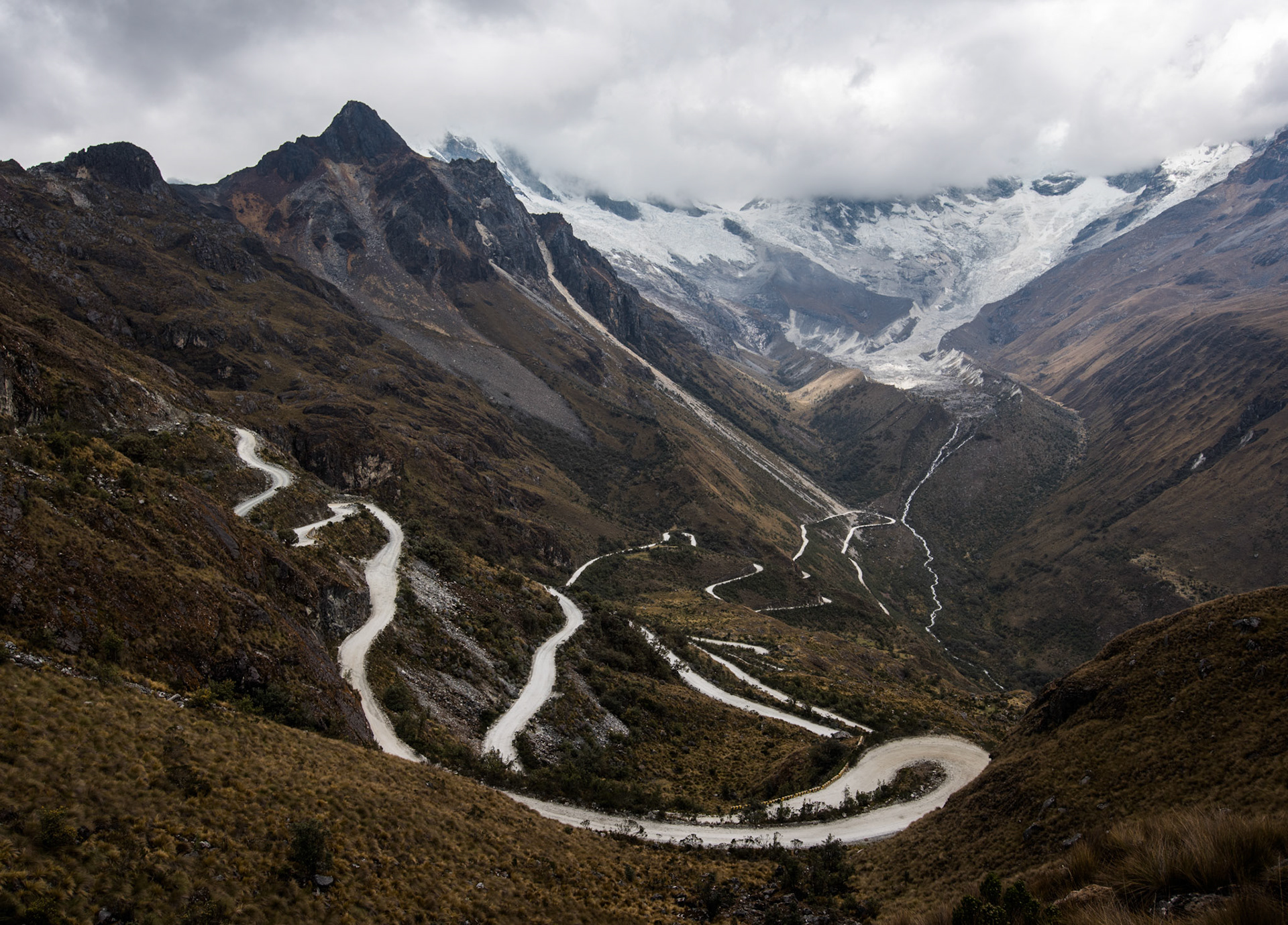
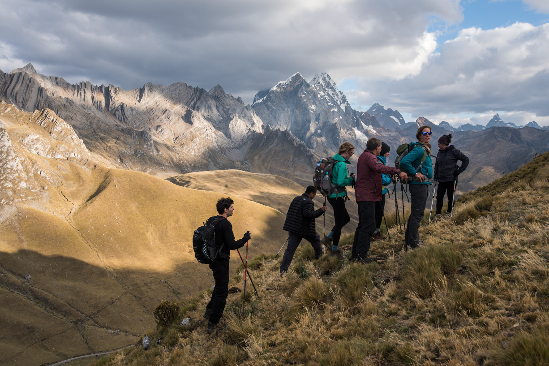
Views of the stunning switchback tracks that we travelled on.

The next day we awoke to crisp and clear blue skies. This was not something I was going to ever take for granted, but as the trek went on this crazily lucky weather was to continue perpetually. We had a long five-hour drive, stopping on some stunning viewpoints to take in the mountains that we would soon be in amongst.

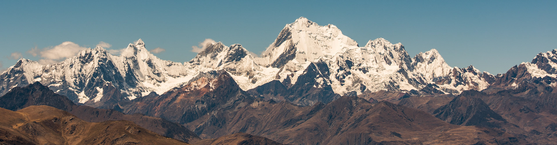
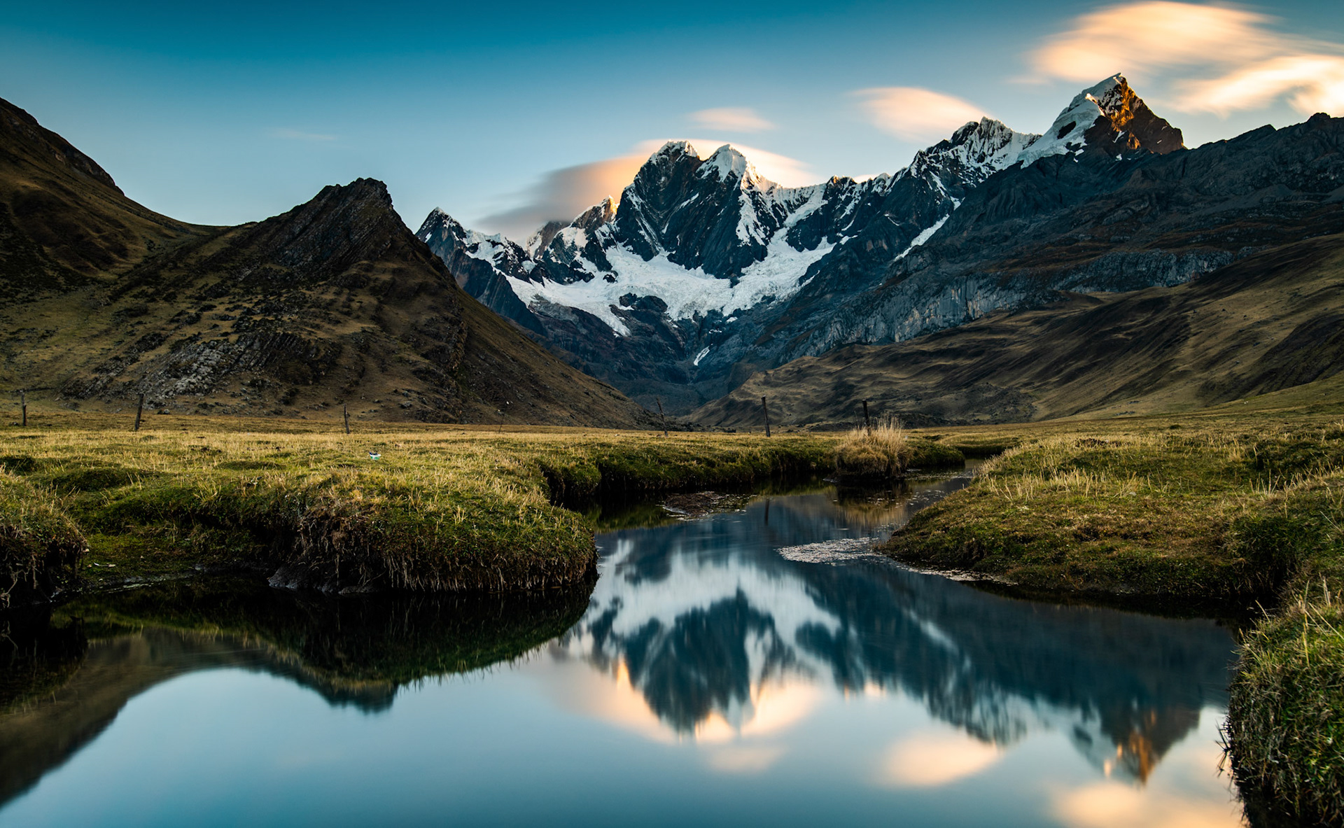
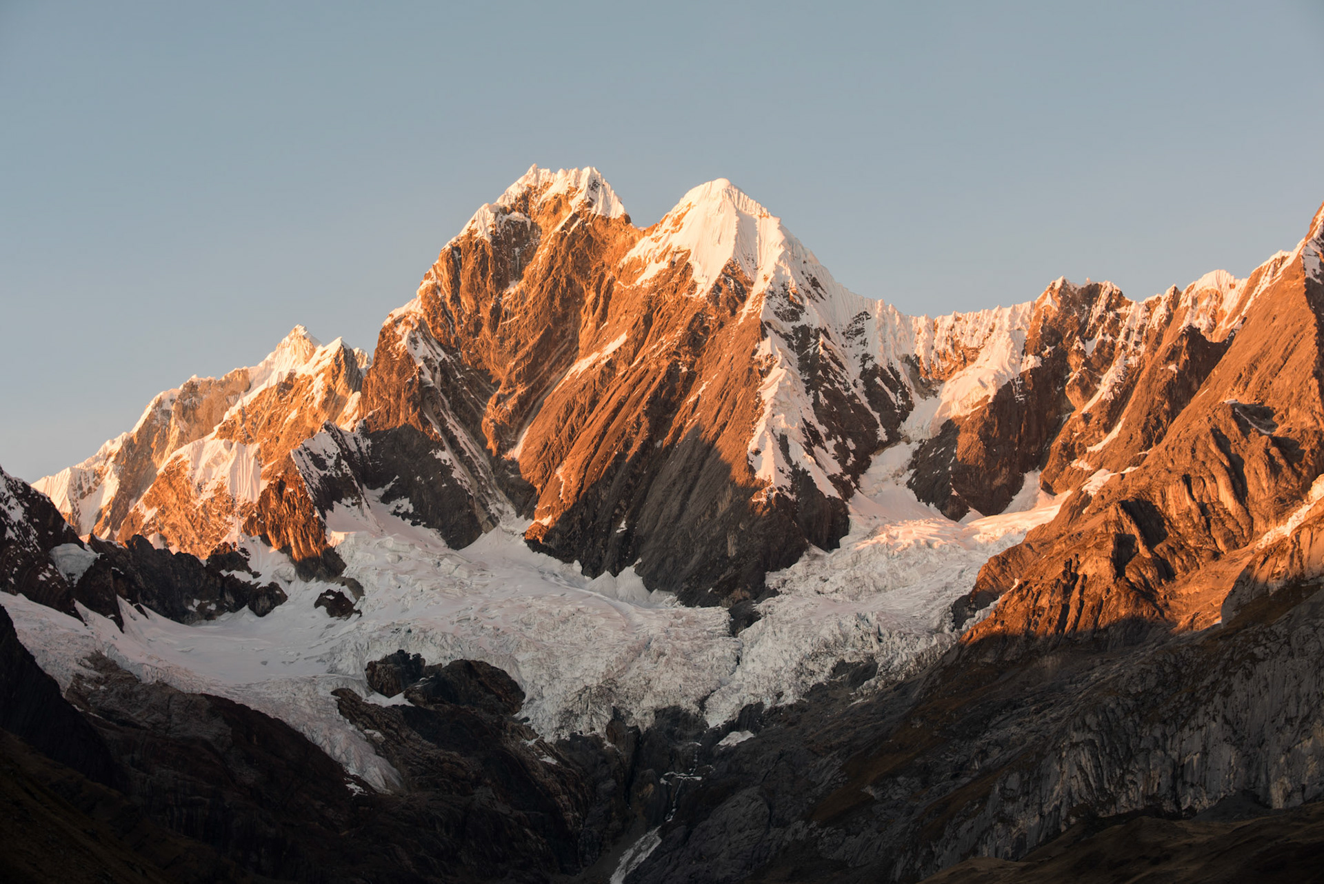
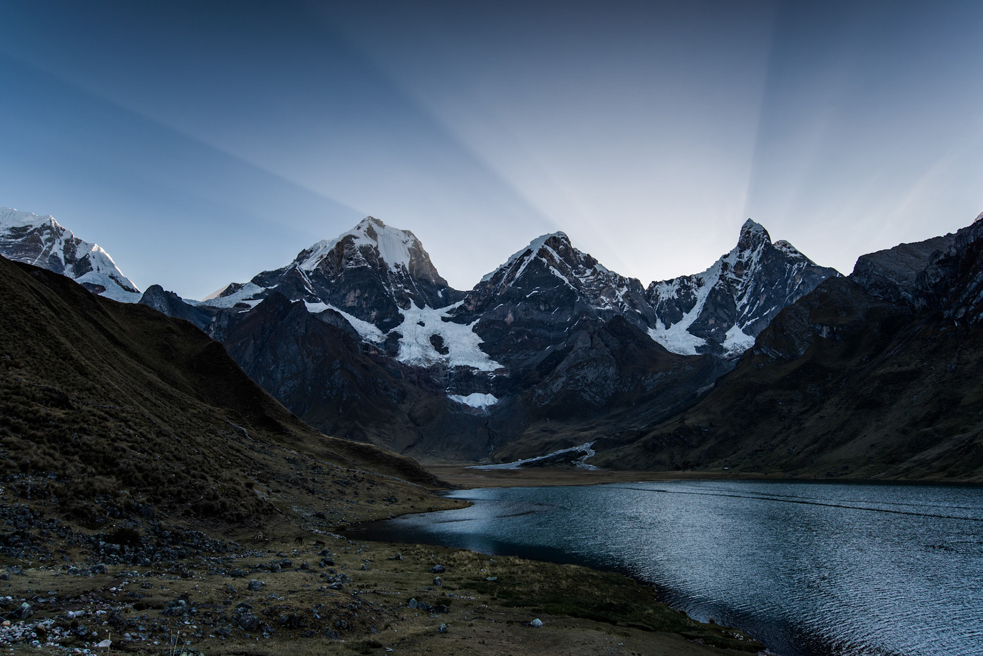
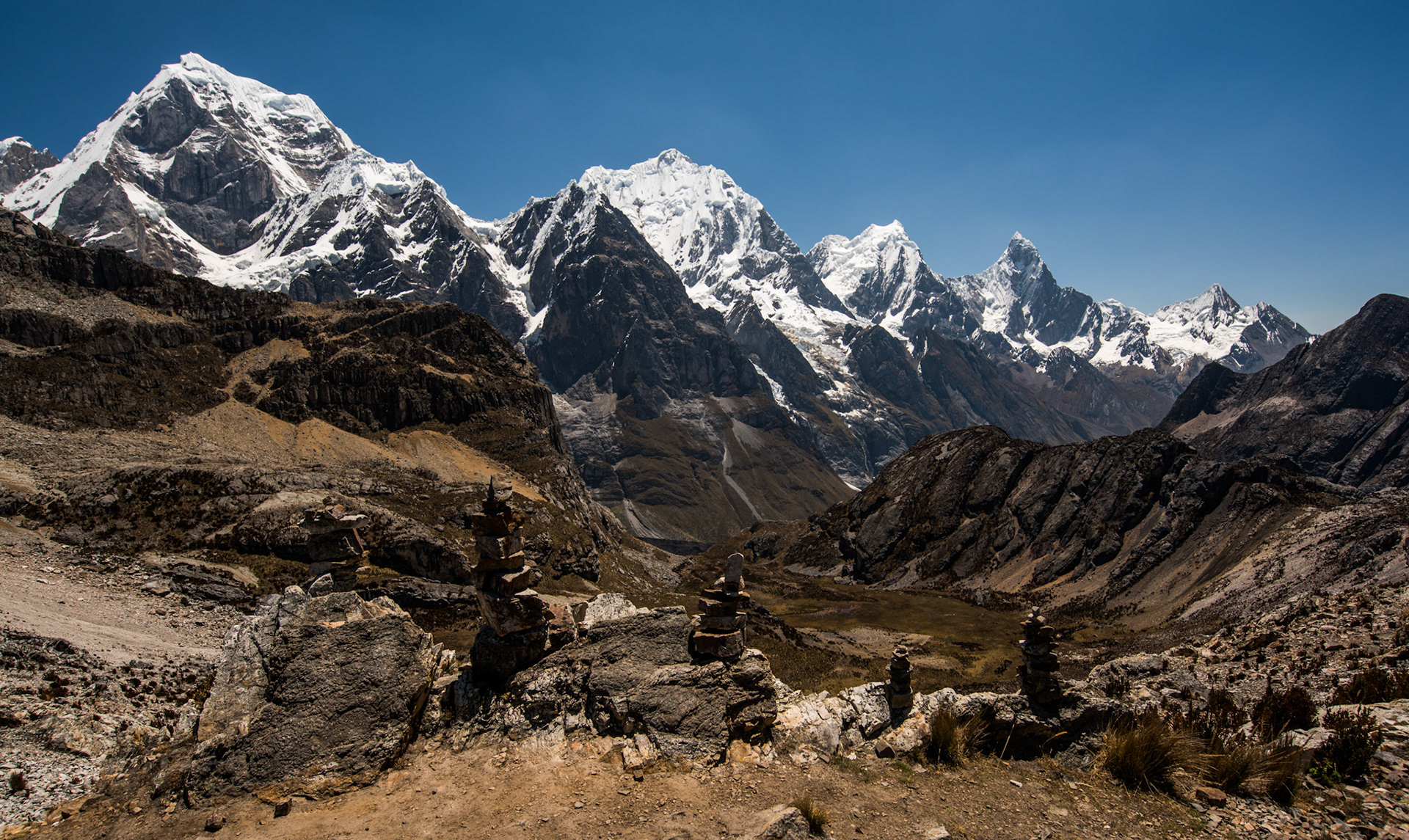
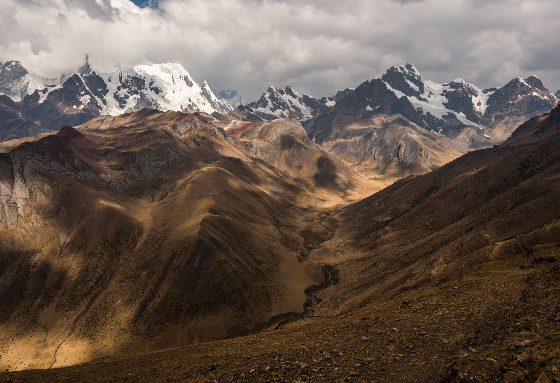
The Cordillera Huayhuash in all its panoramic glory...

Once off the main highway, we took once more to the bumpy rock roads, passing through tiny remote establishments. Outside the heat was strong, with cacti taller than a man growing out of the rocks. We passed through a particularly remote and dusty valley, which made me think of the Hills have Eyes. The tour guide said that if we broke down here, we would probably be staying the night.
We climbed up and up, coming to a small group of houses which was to be the starting point of the trek. At one point we had to get off the vehicle so that the weight wasn’t too much for the tiny wooden bridge that took us over a river crossing. We passed onto a grassy area, where we would camp for the first night. Cuartelhuain was the name of the spot, sitting at 4180m above sea level. As the sky started to turn golden, we took a short walk up a hill to catch out first sunset in the mountains. I could see two glaciers coming off the steep slopes of the largest mountain. The main thing that struck me was the temperature change between up here and the valley below. The sound too. It was deafeningly silent and still in the mountains.

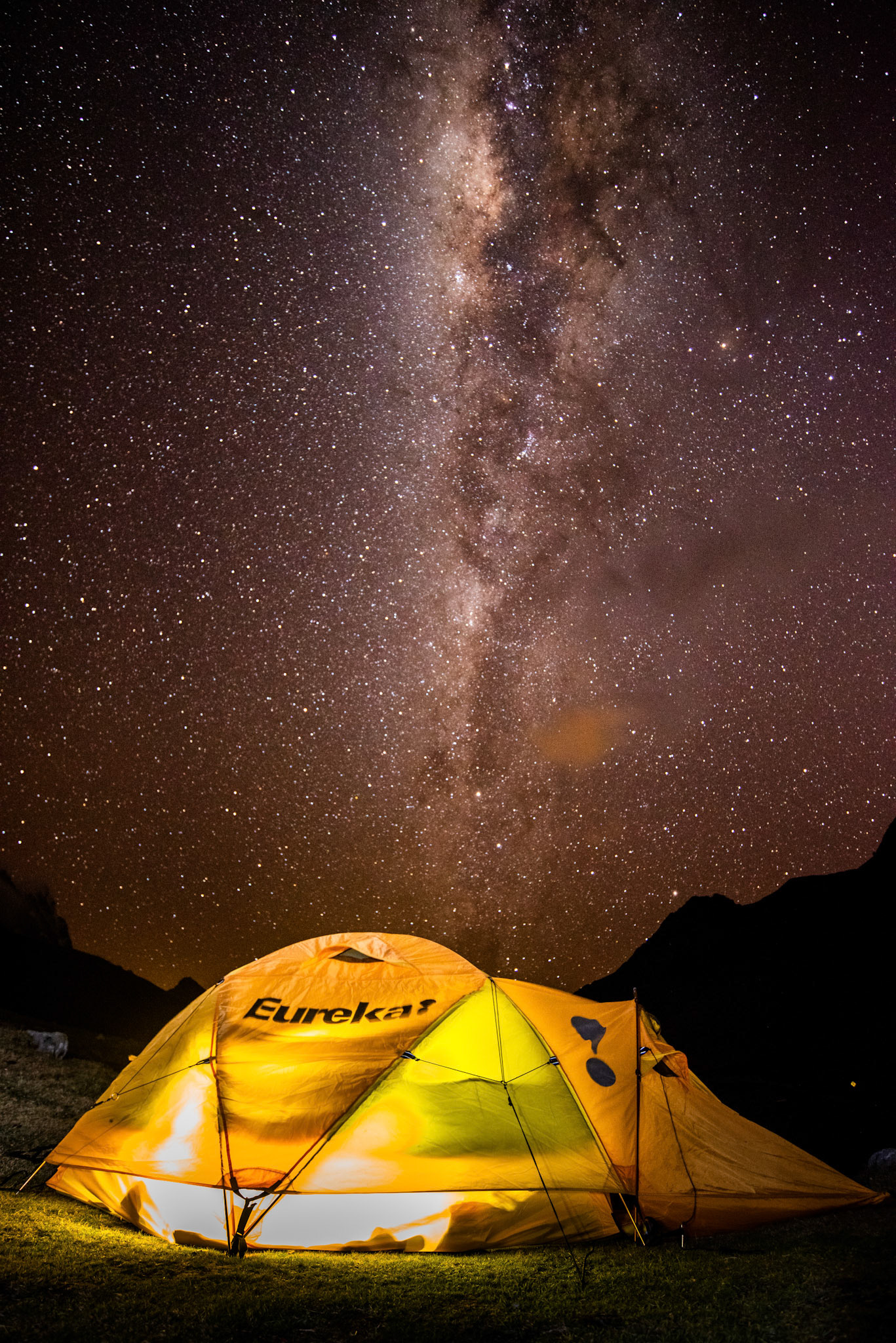
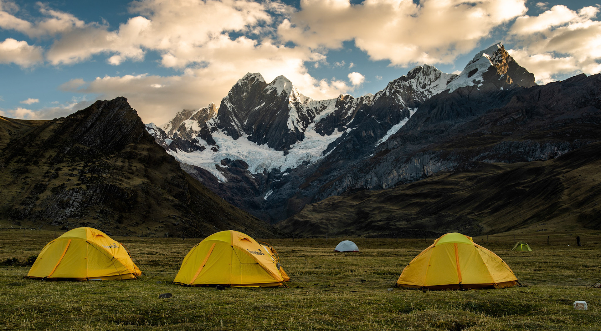
The exclamation on the tent was very apt for my feelings that night!

 The sky was turning clear before dusk, so I tried my luck at some stargazing. I have seen very dark skies along the Southern English coastline, where you can really make out the milky way. In the Andes, however, I was blown away by how clearly I could see our galaxy with the naked eye. Take a look below to see just how clear the skies were. Bare in mind that I barely had to edit the sky in this shot.
We then began our trek the next day, hiking over some incredible mountain passes. The nights and mornings were below freezing, but the day would heat up as we hiked in the morning sun. We would regularly ascend by 1000m, before descending down the same height into the next valley to camp the night. All the while, the magnificent porters would head out on their donkeys, carrying the tents, food and equipment with them. They would have set up camp by the time we arrived for the evening. I truly marvel at their support and I am forever indebted to them for making my trip possible.
​​​​​​​
Our first hike was greeted with Andean Condors swooping above our heads as we reached the top of Cacananpunta pass (4960m). We descended to our first campsite near Laguna Mitucocha, with incredible views looking up to Jirishanca, a 6094m high peak towering above the lake. I was lucky enough to take images of the mountain and lake as the sun went down, as well as when first light hit the massive peak. Needless to say, the mountain looked amazing under the stars… For dinner, one of the guides and the porters headed out to the lake for some night trout fishing. For dinner we had Ceviche from the lake, which is a Peruvian seafood dish of fresh raw fish cured in lemon and lime.

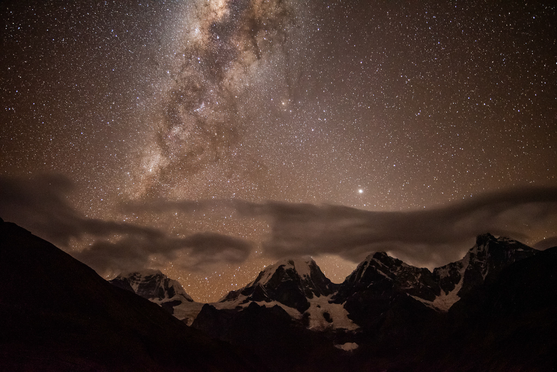
Possibly my favourite shot from the trek.  The southern milkyway dwarfs even the giant peak of Jirishanca ​​​​​​​
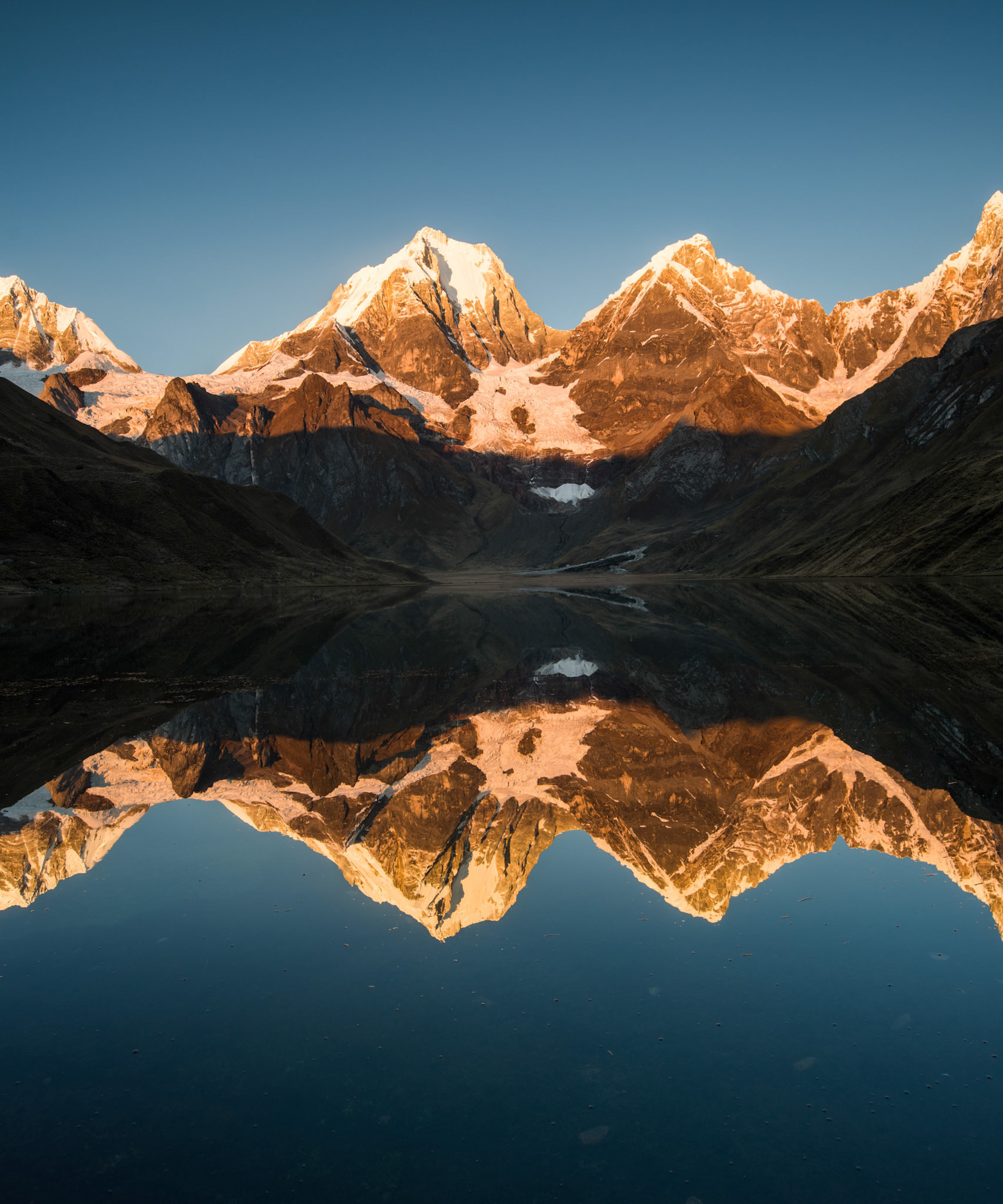
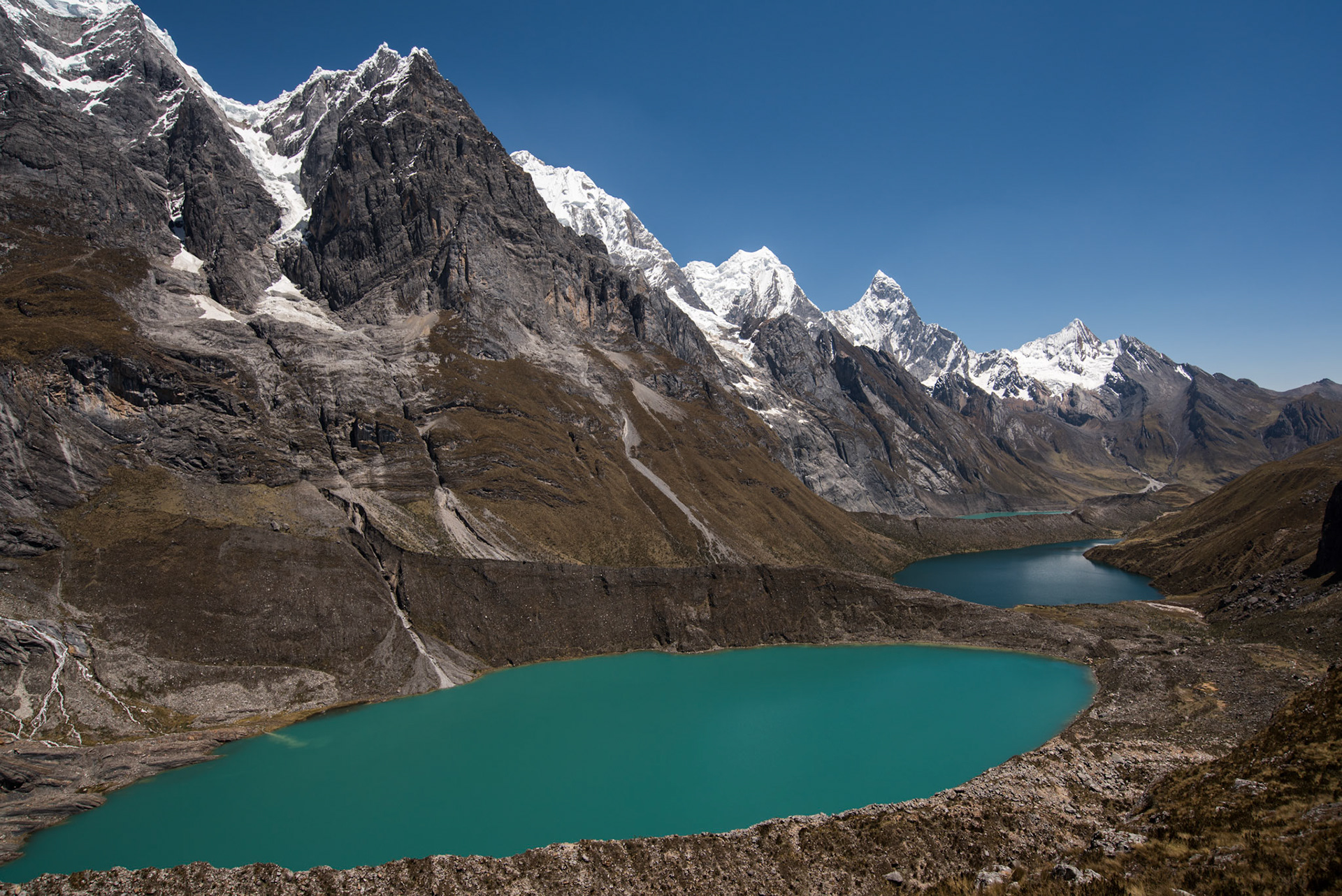
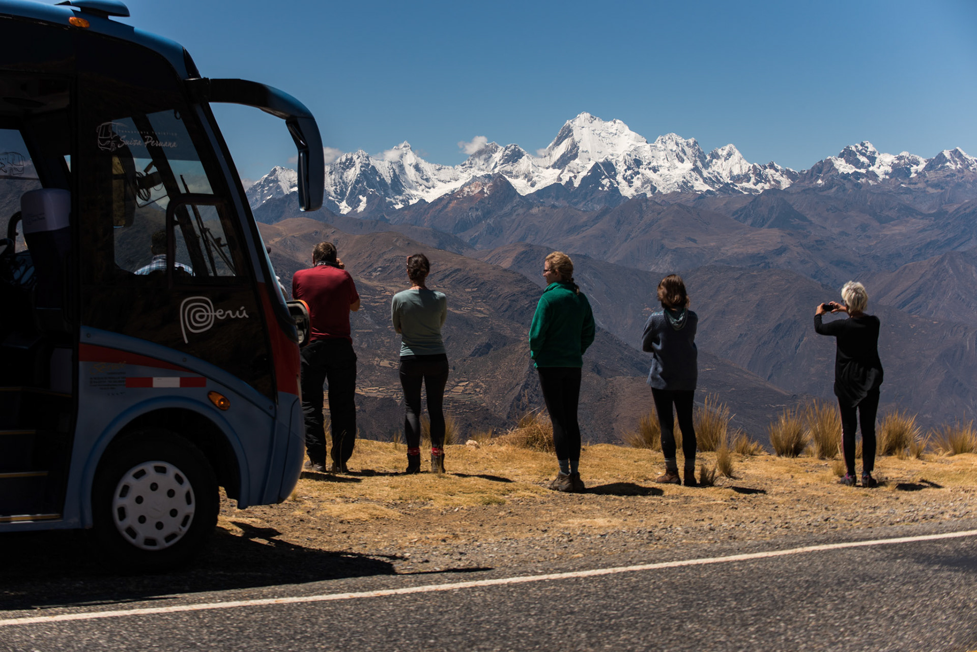
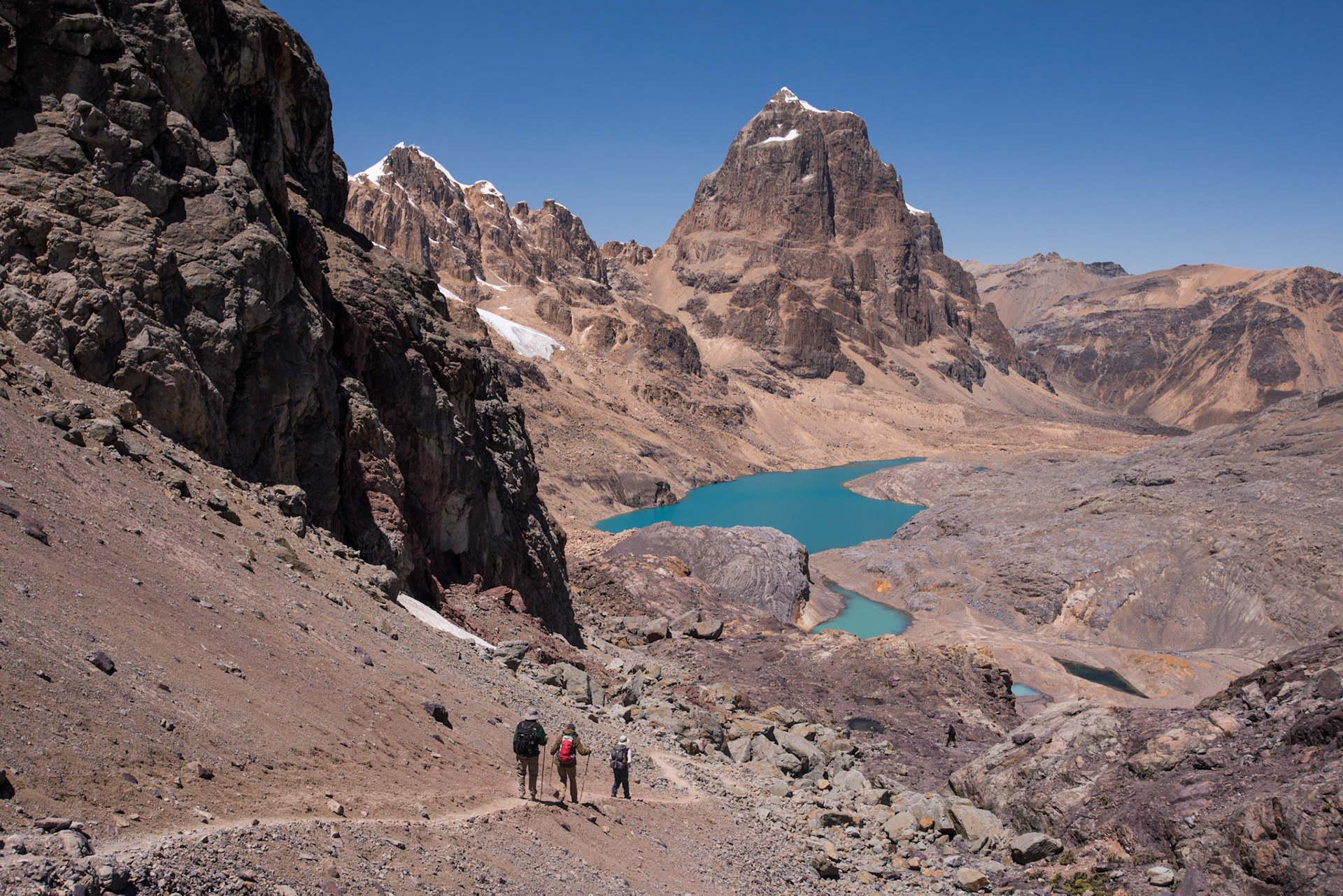
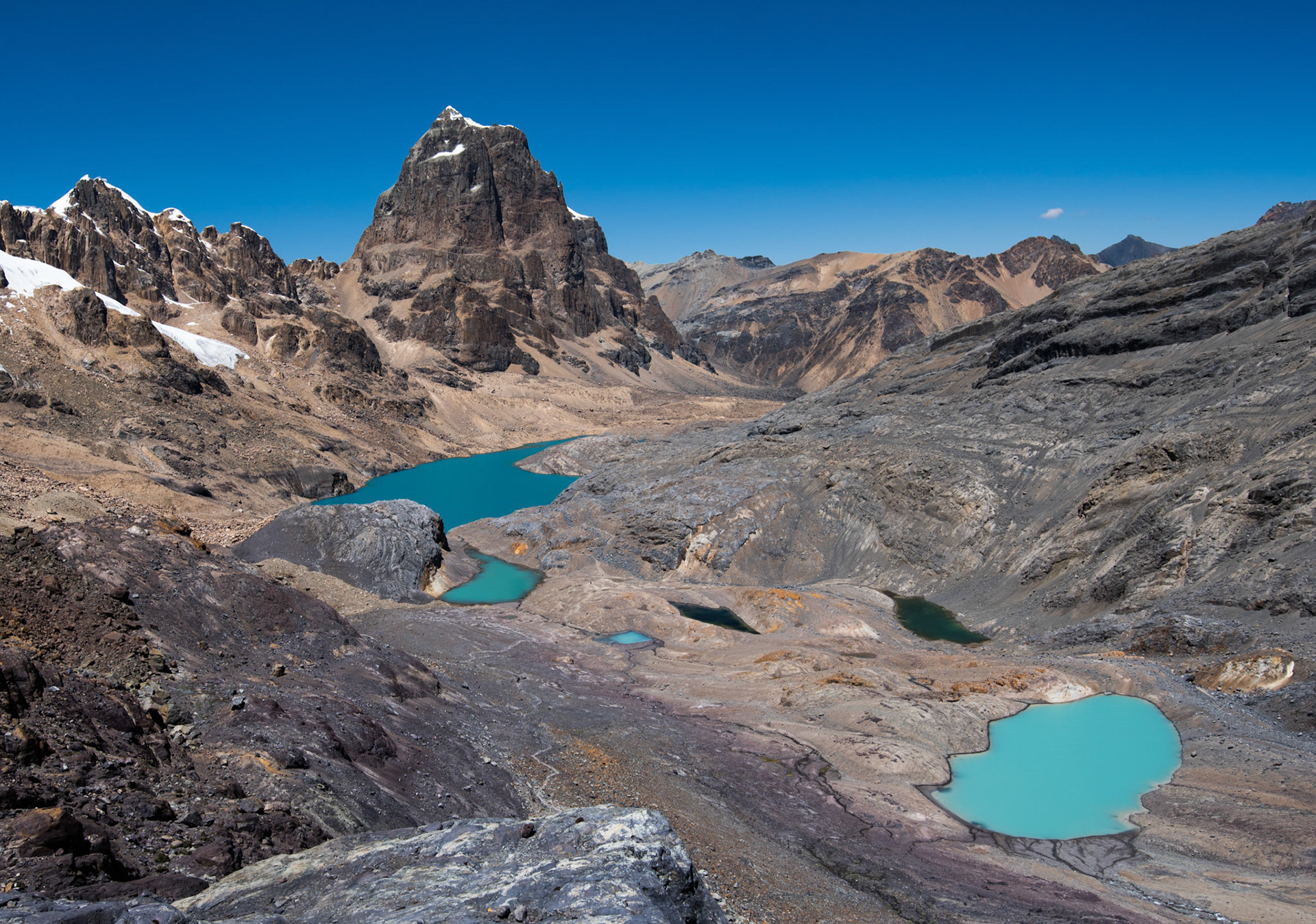
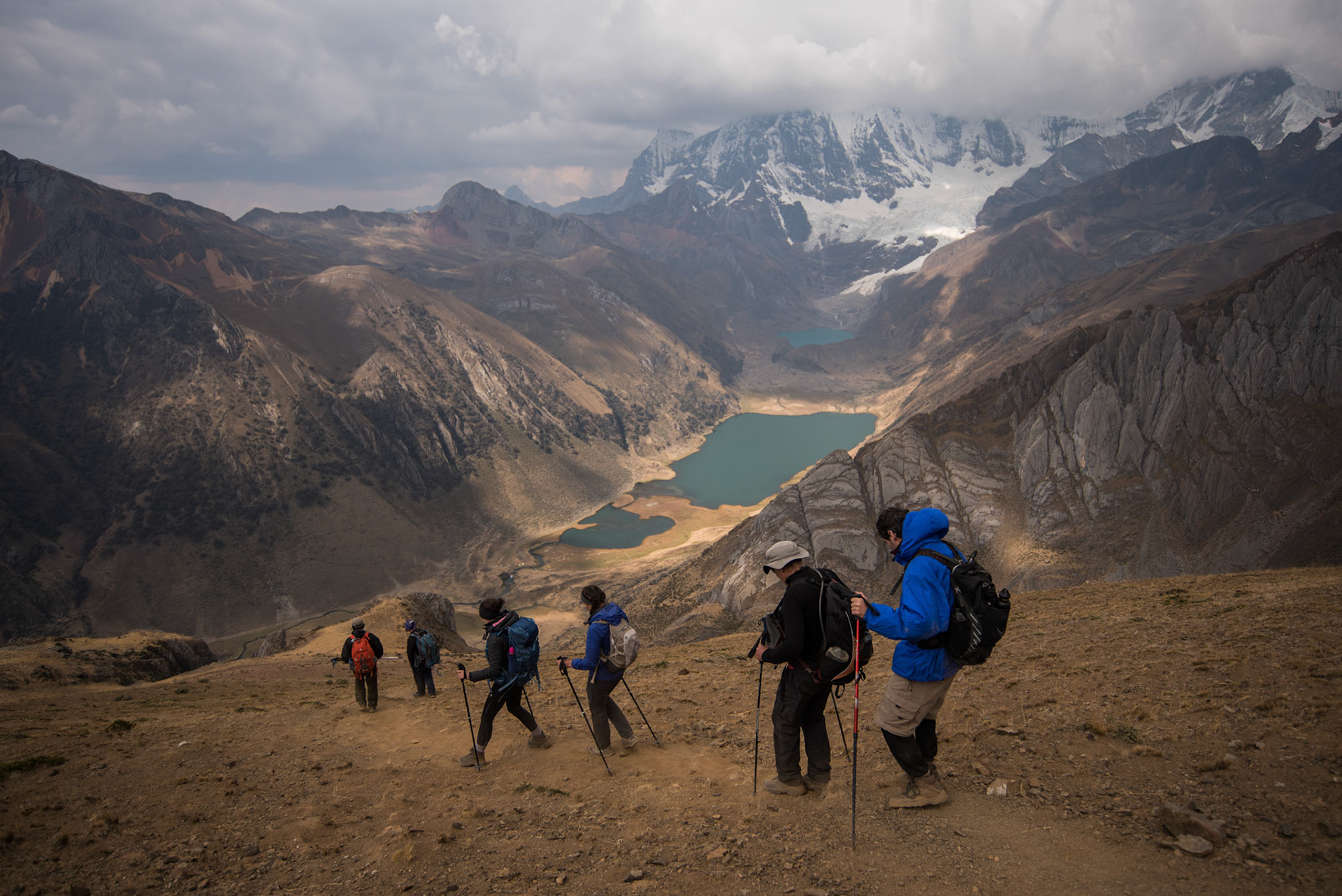
After a full day of hiking,  we next camped directly in front of Laguna Carhuacocha, with giant snow-capped peaks rising out of the land. We all awoke for sunrise, hoping to catch the red glow on the mountains. The light on the rocks was so intense and red that it was almost impossible to believe what I was seeing was really happening. The sheer scale of the peaks really humbled my perspective, where for once I was just an observer and side character to something truly majestic and powerful.

The next day we began another ascent up to the Siula Pass, all the while looking at the incredible mountains that are Jirishanca, Siula Grande and Yerupajá. We passed Laguna Gangrajanca, where we hiked up to a viewing point overlooking the amazingly coloured turquoise lake. I have seen the colours of Morraine Lake in Canada on a cloudy day, but the colour of this lake in the clear sun was just something else. You often half-believe the photos you see of these glacial lakes, but the water is genuinely that colour.
At the top of the pass, you get a view of the popularised Mirador Tres Laguna. You can see three lakes: Laguna Gangrajanca, Laguna Siula, and Laguna Quesillococha, towered over by the mighty mountains aforementioned. This was a very steep ascent up to the viewpoint, with another difficult section to go before we reached the top of Siula Pass at 4,830m. On the ascent up to the lake viewpoint, I began to experience a bad headache. I could barely move 50 paces before my head would be banging and throbbing and I would feel extremely weak. I managed to make the top of the pass that day, so was relieved to be on the flat, then downhill to the next campsite. The views that day were the most stunning you could imagine, but it was a hard-fought uphill battle.

Mirador Tres Laguna

Siula Pass, 4,830 m

On the other side of the pass, there are wonderful views to the peaks of Carnicero and Trapecio. After a long descent, we made it to Huayhuash campsite. I remember being very relieved to have reached the comfort of a nice long sit down. We used a pulse oximeter in the tent, which showed that my blood oxygen levels were well below what they should have been. I seem to remember my levels were around 68%, but do not quote me on that. I definitely had altitude sickness though. My friend gave me a few of his pills to combat the symptoms, which I took over the next few days.
We awoke for another long day, heading up to Punta Cuyoc at 5,050m. Unfortunately, my sickness meant that I simply could not keep pace with the rest of the group. It was agonisingly slow to make a few metres of elevation and I reached a point where I had to stop. Luckily for me, there was an ambulance close at hand. This being the affectionately named horse, Lucero. Jumping on Lucero and letting the old hand do the work, I hung on as this sure-footed horse made his way up very steep and rocky terrain. He got me to the top, where we were up very high at the snow level. You could reach out and touch the glacier on the Cuyoc mountain. This was the highest we had been, with bitterly cold strong winds forcing us to shelter. We descended towards what seemed like an otherworldly landscape, with a tall rocky peak emerging from a baron land dotted with small turquoise lakes. 

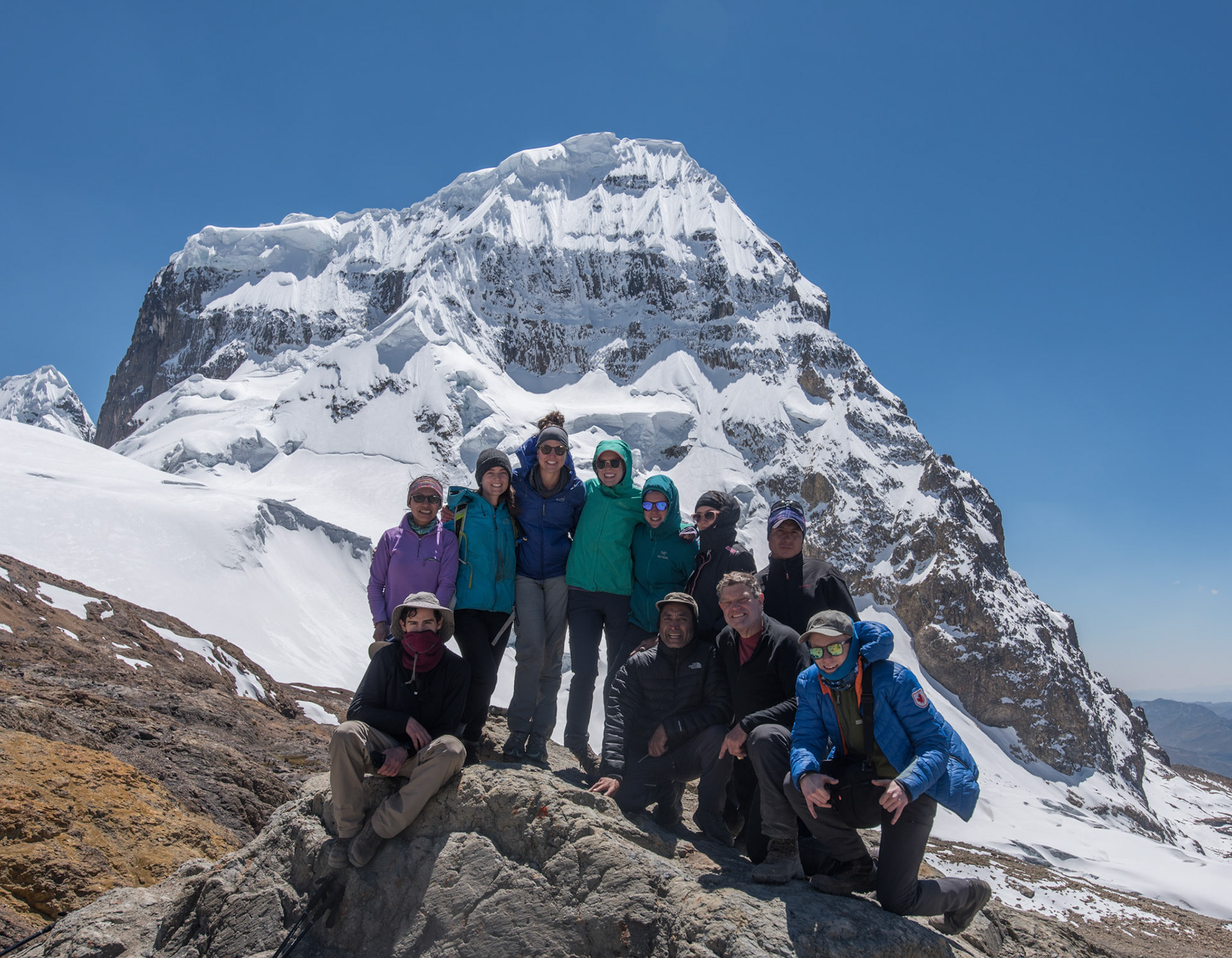
Our group photo at the top of Punta Cuyoc, 5,050 m

The fabulous view on the other side of the pass
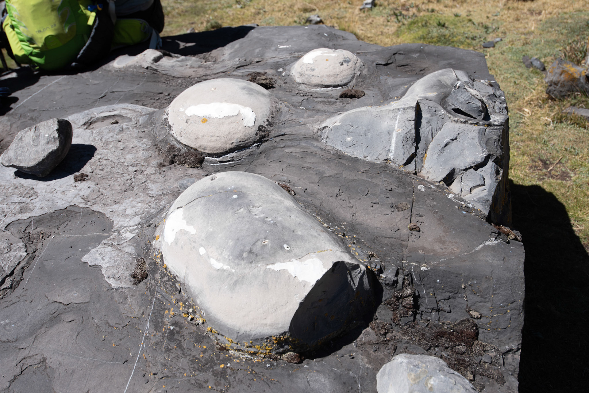
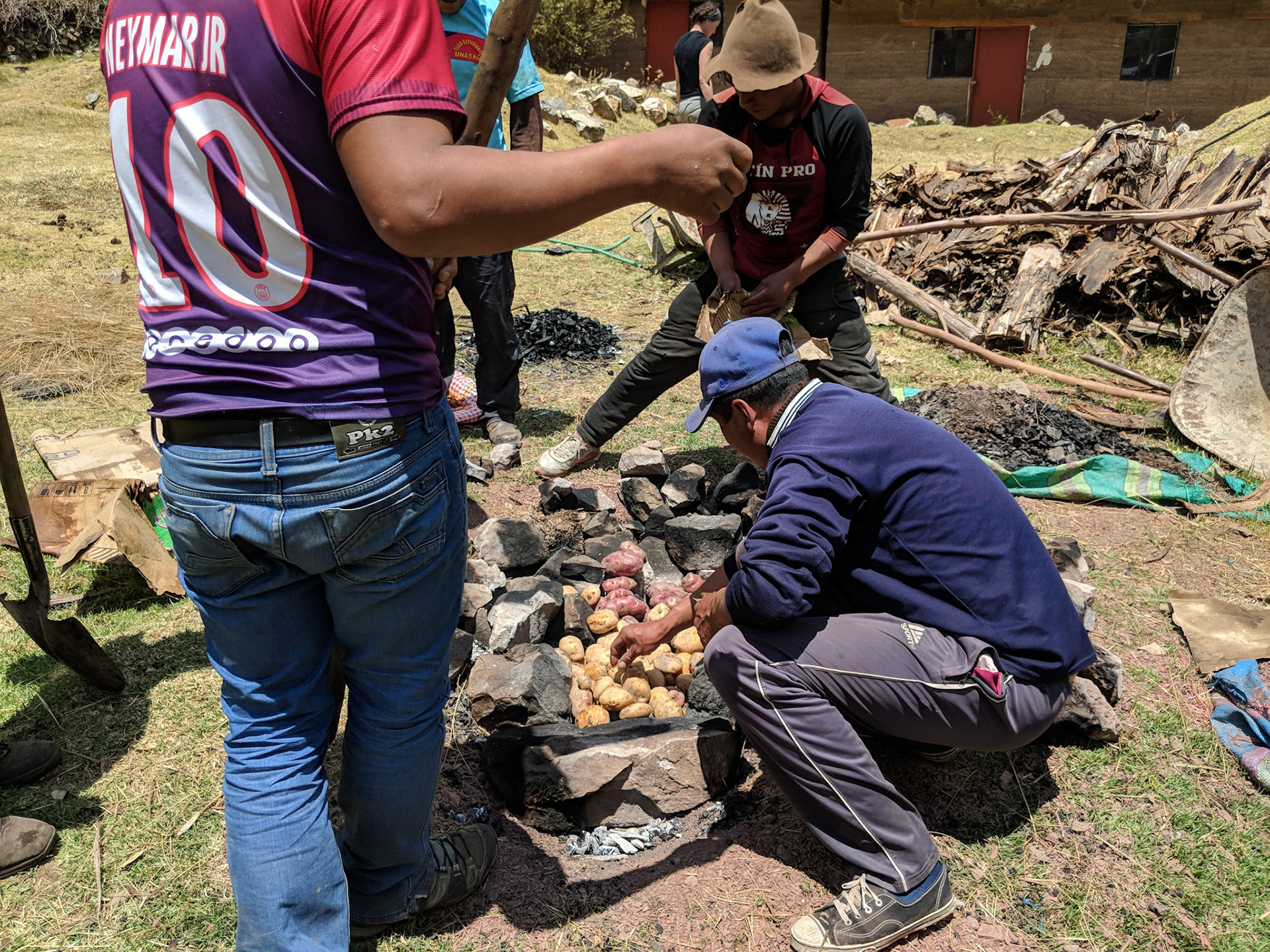
I believe it was this day that we had the option to hike up to San Antonio Pass. I had my sights on this viewpoint since coming to Huayhuash, but my sickness prevented me from joining the others who took up the challenge. I was regrettably taken on Lucero to the campsite in Cuyoc, where we spent our night. At 5080m, San Antonio Pass was the highest that we got (not me ofcourse), and my friend’s photographs capture how stunning this vista really was. At some point on the trek, we passed a great slab with large round objects embedded in its body. The guides said it was dinosaur eggs. To this day, I am still not sure if it was true, but I do not find it hard to believe. I did look up known photographs of dinosaur eggs and it does look like it is. I have a picture below to decide for yourself.

Dinosaur Eggs?

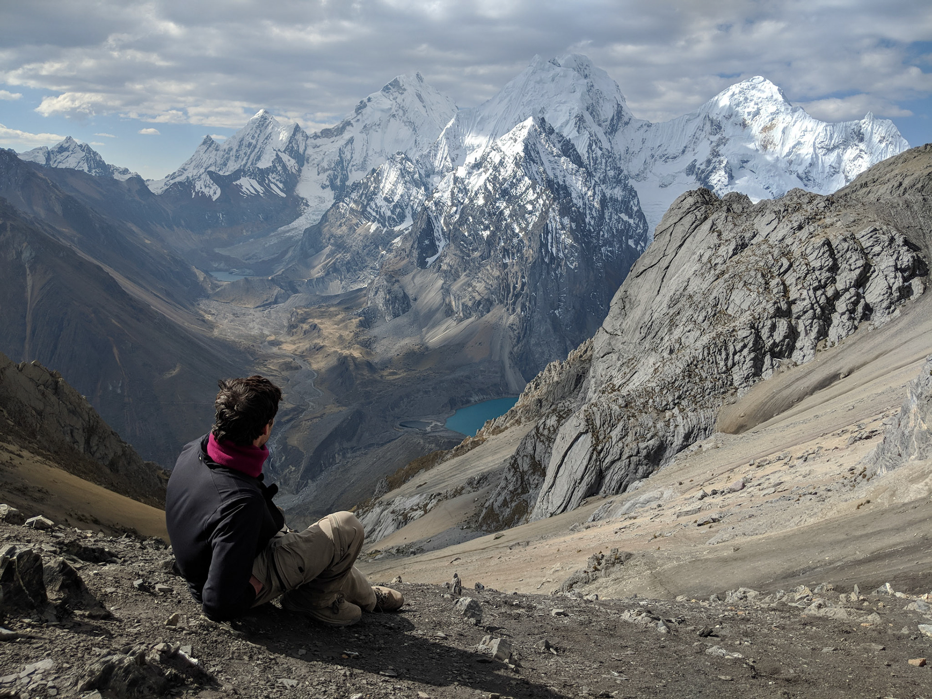
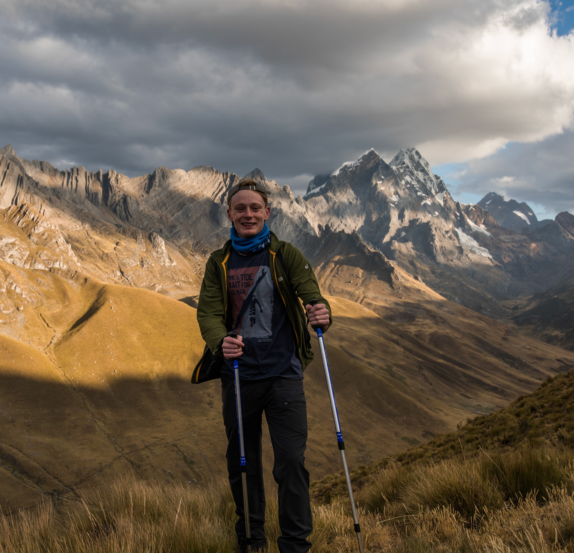
Sadly, the closest I could get to this viewpoint was a photo of my friend enjoying the view. San Antonio Pass, 5,080 m
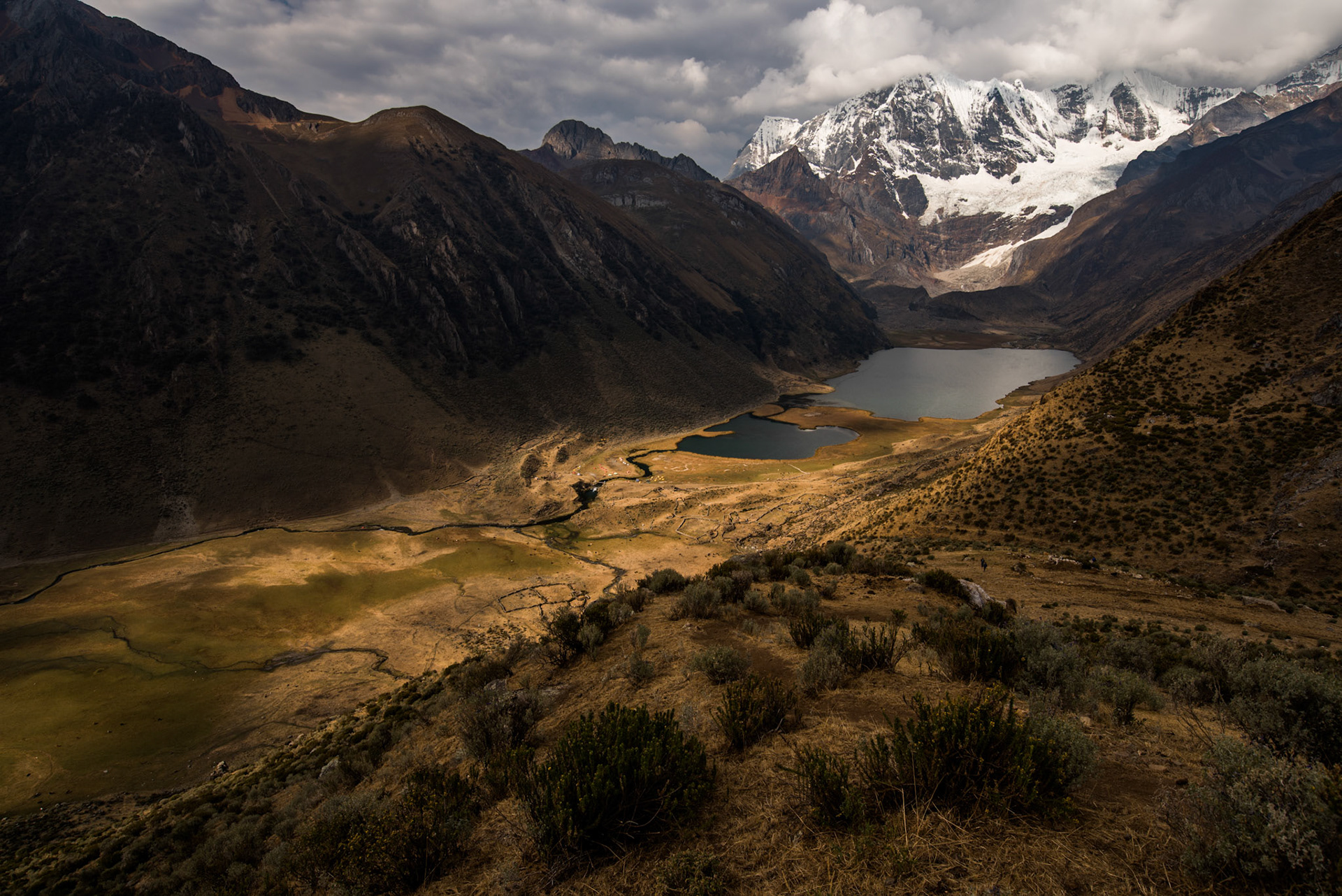
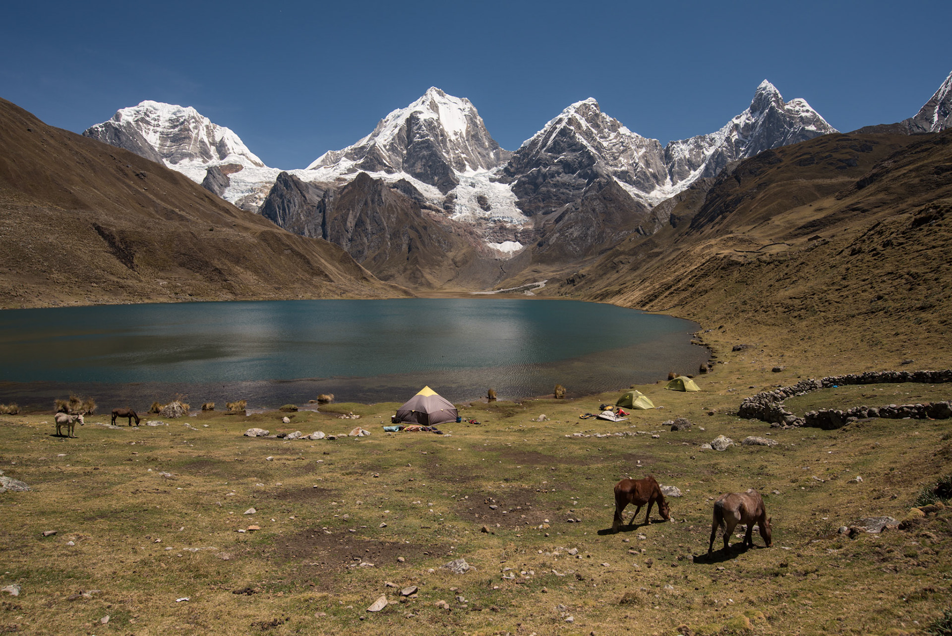
The next day I felt much better after a good night's sleep, eager to reclaim my enjoyment of the hike. The weather started to cloud over more for the next few days, but we could still frequently observe the summits of the mountains. We climbed up over more high passes, enjoying the last few days of our hiking. In what I believe was our final night of camping, we pitched up tent not far from the shores of Laguna Jahuacocha. We could hear the thunder of the glacier as chunks broke off in the night. We awoke for what I believe was the final day, up to one last pass before a long slog down to the finish line in at the village of Pocpa. It got warmer and warmer as we started to lose altitude, descending what felt like an eternity before we finally passed through the gates and into the village..

Laguna Jahuacocha.

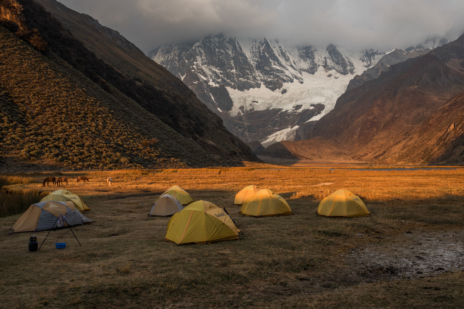
Our final campsite at Laguna Jahuacocha.

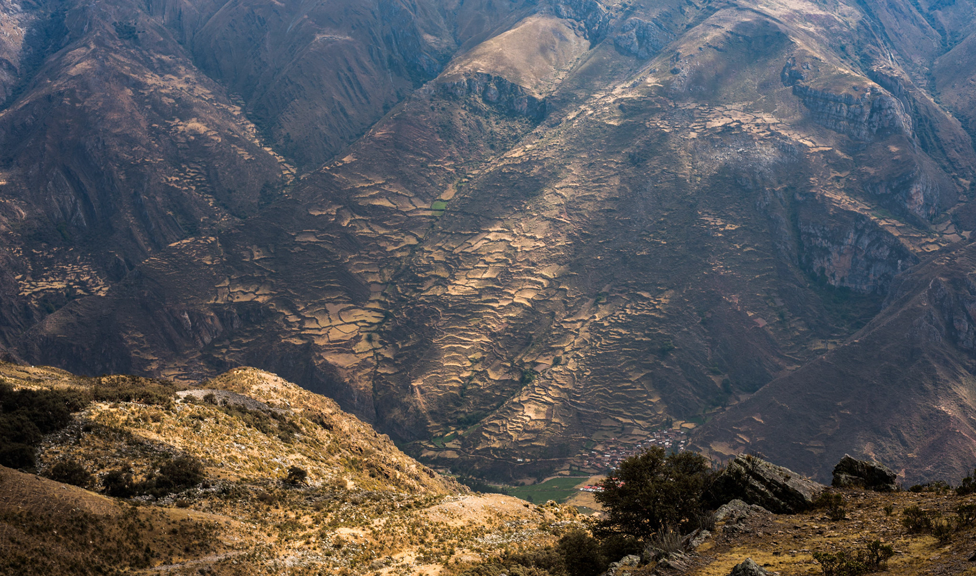
Terrace walls on the slopes above Pocpa, still far below us.

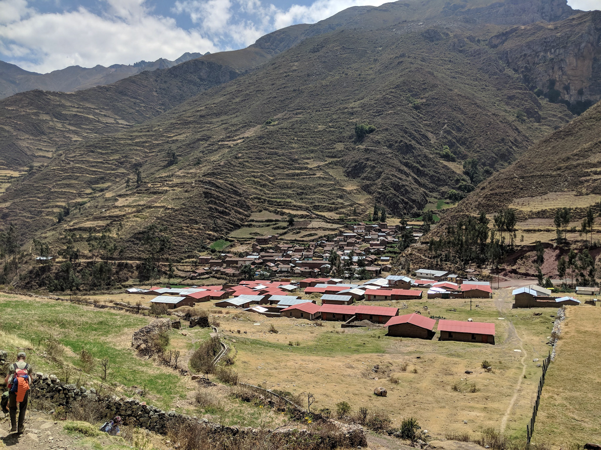
Finally hitting level ground at the village of Pocpa.

As a celebration for finishing the trek, the locals made us Pachamanca, a traditional Peruvian dish baked with the aid of hot stones and being buried underground. Most commonly eaten in the Andes, it has an important cultural context with its origin coming from the Incan empire. Red meat, lamb, pork, cuy and chicken are all cooked together, along with potatoes, corn, green lima beans, and yucca. It was marvellous to watch them prepare this dish with such beautiful mountains surrounding us. 


Once we had finished at Pocpa, we took the long drive back to civilisation, staying a night in the beautiful Chiquián. The hotel we stayed in was rustic yet quaint and beautiful. The next day we began our long coach journey back to Lima. On the way, we stopped at a seaside restaurant right on the coast of the Pacific. The air was thick with haze, a million miles away from the crisp Andean skies. We drove into Lima, where we were stuck for hours in the heaviest traffic I have ever seen. The roads were a complete free-for-all. I am awfully glad I did not have to drive in this place!

Chiquián, nicknamed ‘the mirror of the sky’.

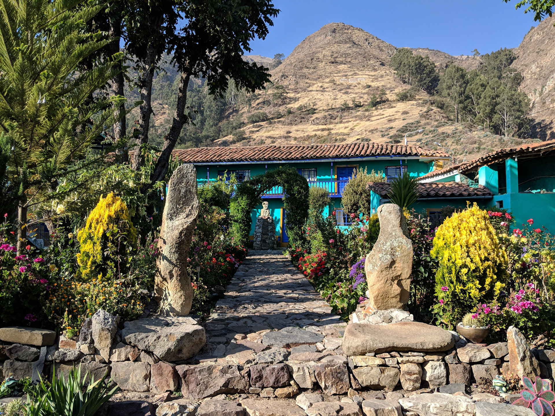
The stunningly unique Los Nagales Hotel in Chiquián.

The next morning I sadly said my goodbyes to the group, having built great friendships. We had Australians, Americans and British, a wonderful group of mixed ages and backgrounds. I bid farewell and waited for the evening to fall before catching my plane onto the next stint of the trip. Chile and Argentina were awaiting me...
The two guides had been wonderful company, with Henry being a fantastic source of laughter and memories.  Ronal was a true adventurer, with his love for the mountains clearly observable at any given time. Every day they would praise Pachamama for the tremendous fortune we had in the weather department. In Incan mythology, Pachamama is a mother-earth type goddess, presiding over planting and harvesting and embodying the mountains. The porters and locals also kept their heritage important to them, speaking Quechua and claiming lineage back to the Incas.
It was not only the guides that made this trek as good as it was. I sincerely thank the porters who helped us move equipment and supplies on their donkeys and horses. I also thank Lucero for saving the day when I was sick. I am forever grateful for the trip, which is why I decided to write this blog post. These words and photographs have cemented the memories for me, so I can always come back and relive those incredible moments. Thank you for taking the time to read this. I wish you well on your travels and adventures.

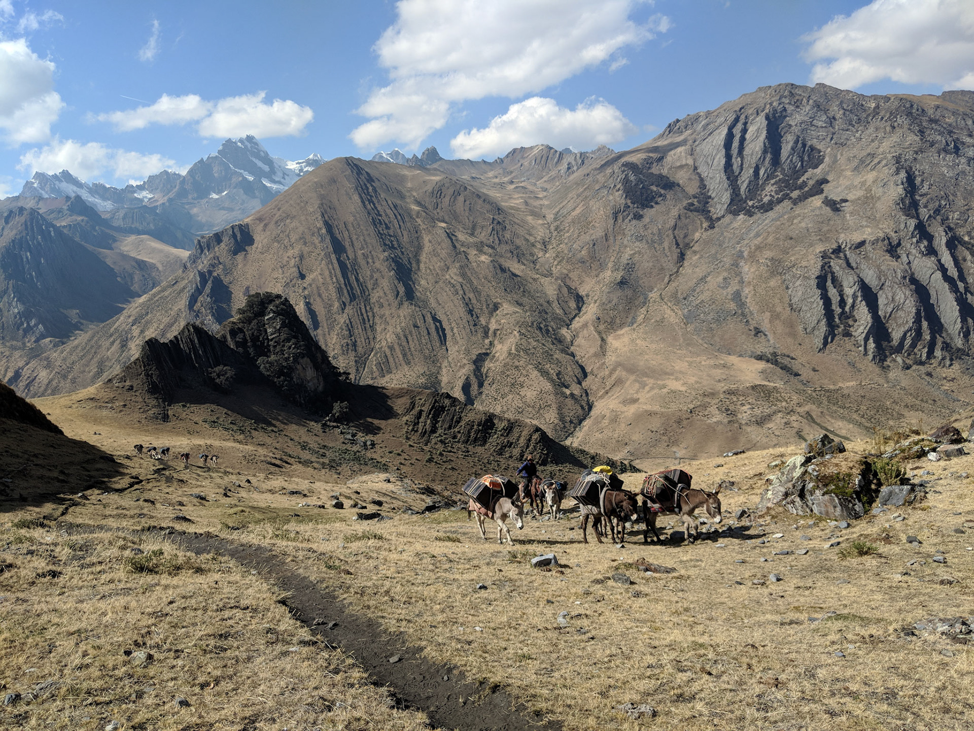
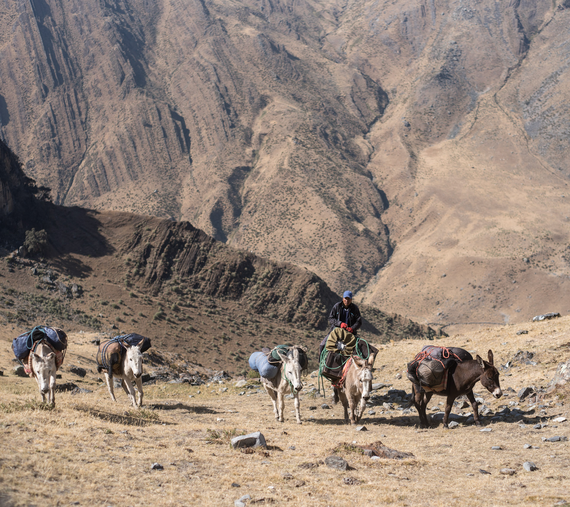
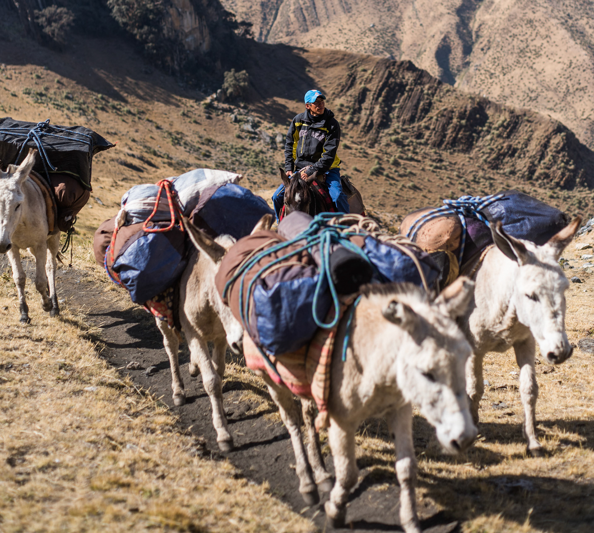
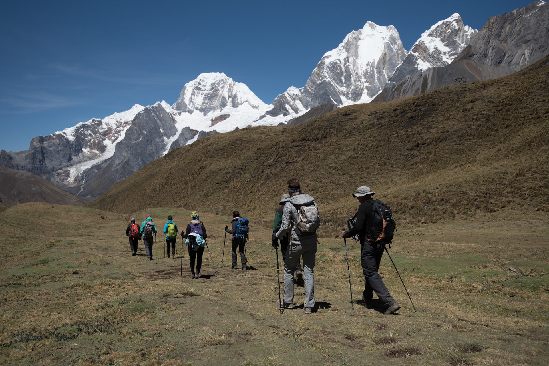
Watching the donkeys pass over this incredible landscape was a highlight of each day.

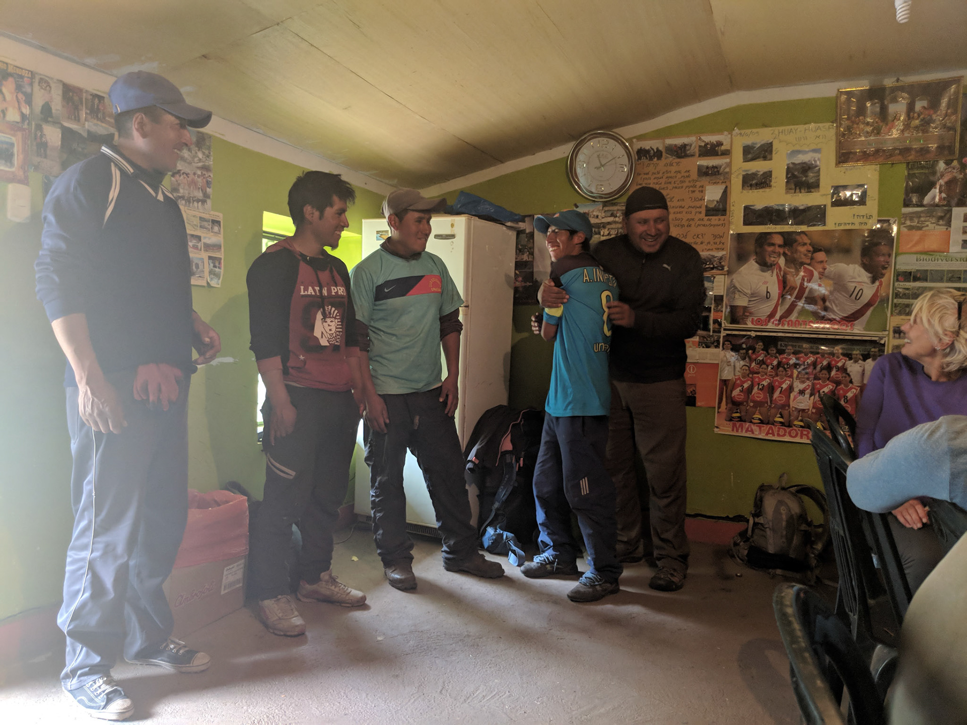
Henry (on the right) and the porters.

Back to Top